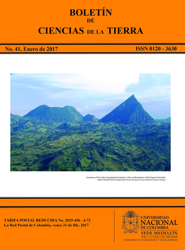
Inventory of the sites of geological interest, in the southwestern of Antioquia Colombia
Inventario de sitios de interés geológico en el suroeste Antioqueño Colombia
DOI:
https://doi.org/10.15446/rbct.n41.54841Palabras clave:
Sites of Geological Interest, Geoturism, Southwestern Antioquia, Geological Heritage (en)Sitios de Interés Geológico, Geoturismo, Suroeste Antioqueño, Patrimonio Geológico (es)
Descargas
Referencias
Prosser, C.D., Brown, E.J., Larwood, J.G. and Bridgland, D.R., Geoconservation for science and society - An agenda for the future, Proc. Geol. Assoc., 124(4), 2013.
Cárdenas, G. y Restrepo, C., Patrimonio geológico y patrimonio minero de la cuenca carbonifera del suroeste antioqueño, Colombia, Boletin Ciencias de la Tierra. 18, pp. 91-102, 2006.
Henao, A., Osorio, J. y Hurtado, E., Propuesta para la divulgación del patrimonio geológico del departamento de Antioquia, Colombia. XIV Congreso Latinoamericano de Geología y XIII Congreso Colombiano de Geología, pp. 312-313, 2011.
Molina, J. y Torres, H., (). Aproximación al patrimonio geológico y geodiversidad en Santafé de Antioquia, Olaya y Sopetrán, departamento de Antioquia, Colombia. Boletín Ciencias de La Tierra. 2012. Availabel at: http://www.revistas.unal.edu.co/index.php/rbct/article/view/37201/43371.
Osorio, J. y Henao, A. (2012). Propuesta para la divulgación del inventario de reconocimiento del patrimonio geológico del departamento de Antioquia - Colombia caso aplicativo. Congreso Latinoamericano de Prevención de Riesgos y Medio Ambiente, Santiago de Chile-Chile. Available at: http://paritario.utalca.cl/docs/MESA_A_PONENCIAS/A_19_Propu esta_Divulgacion_Inventario_Patrimonio_Geologico_Antioquia_CO LOMBIA_OSORIO_HENAO.pdf
Jaramillo, E., Caballero, J. y Molina, J., Patrimonio geológico y geodiversidad: Bases para su definición en la zona andina de Colombia: caso Santa Fe de Antioquia. Boletín Ciencias de La Tierra, 35, pp. 53-66, 2014.
Caballero, J., Rendón, A., Gallego, J. and Uasapud, N., Inter-Andean Cauca river canyon. In landscapes and land forms of Colombia. Springer, pp. 155-166, 2015.
Rendón, A., Henao, A. y Osorio, J., Propuesta metodológica para la valoración del patrimonio geológico, como base para su gestión en el departamento de Antioquia. Boletín Ciencias de La Tierra, 33, pp. 85-92, 2013.
Henao, A. y Osorio, J., Propuesta Metodológica para la identificación y clasificación del patrimonio geológico como herramienta de conservación y valoración ambiental. Congreso Latinoamericano de Prevención de Riesgos y Medio Ambiente. 2012. Available at: http://congresopryma.blogutem.cl/files/2012/12/A_11_Propuesta_Metod_I dentificacion_Clasific_Patrimonio_Geolog_HENAO_OSORIO.pdf
Gobernación de Antioquia. Perfil de la subregión del suroeste - Departamento Administrativo de Planeación. Medellín. 2009, 152 P.
Grose, E., (1926). El terciario Carbonífero de Antioquia en la parte occidental de la Cordillera Central de Colombia entre el río Arma y Sacojal (Verlag Von). Verlag Von Dietrich Reimer (ErnstVohsen). 362 P. Disponible en: http://www.accefyn.org.co/cientificos/pdf/emilGrosse/EmilGrosse.pdf
Page, W., Seismic geology and seismicity of northwestern Colombia. woodward-clyde consultants, ISA. 1986, 156 P.
MacDonald, W., Estrada, J., Sierra, G. and González. H., Late Cenozoic tectonics and Paleomagnetism of north Cauca basin intrusions, Colombian Andes: Dual rotation models, 261(4), pp. 277- 289, 1997.
Taboada, A., Rivera, L., Fuenzalida, A., Cisternas, A., Philip, H., Bijwaard, H. and Rivera, C., Geodynamics of the northern Andes: Subductions and intracontinental deformation (Colombia). Tectonics, 19(5), pp.787-813, 2000.
González, H. Mapa geológico del Departamento de Antioquia (Memoria explicativa). Boletín Geológico. Ingeominas, 2001, 240 P.
Monsalve, H. y Mora, H. Esquema geodinámico regional para el noroccidente de Suramérica (Modelo de subducción y desplazamientos relativos). Boletín de Geología, 27(44), pp. 25-63, 2005.
Gómez, J., Montes, N.E., Nivia, Á. y Diederix, H., compiladores. Atlas Geológico de Colombia. Escala 1:500 000. Servicio Geológico Colombiano, 26 planchas, Bogotá, 2015.
Cómo citar
APA
ACM
ACS
ABNT
Chicago
Harvard
IEEE
MLA
Turabian
Vancouver
Descargar cita
CrossRef Cited-by
1. Marco Simbaña-Tasiguano, Estefanía Cabascango-Chiliquinga, José Luis Sánchez-Cortez, Alejandra García-Frank, Henry Grefa-Shiguango. (2024). Geoeducation strategies in the Amazon, Napo Sumaco Aspiring UNESCO Global Geopark. International Journal of Geoheritage and Parks, 12(3), p.465. https://doi.org/10.1016/j.ijgeop.2024.07.008.
2. Marco Simbaña-Tasiguano, David Granja-Guato, José Luis Sánchez-Cortez, Jhonatan Enríquez-Villarreal. (2024). Geodiversity Geoconservation and Geotourism in Napo Sumaco Aspiring UNESCO Global Geopark. Geoheritage, 16(4) https://doi.org/10.1007/s12371-024-01023-y.
3. Luis Hernán Sánchez-Arredondo, Andrés López-Gómez, Sergio Alejandro Garavito-Higuera. (2025). Exploration of mining heritage and evaluation of mining tourism potential in the La Ferrería village, mining territory of the municipality of Amagá, in the northwestern Colombian Andes. International Journal of Geoheritage and Parks, 13(2), p.274. https://doi.org/10.1016/j.ijgeop.2025.03.001.
Dimensions
PlumX
Visitas a la página del resumen del artículo
Descargas
Licencia
Derechos de autor 2017 Boletín de Ciencias de la Tierra

Esta obra está bajo una licencia internacional Creative Commons Atribución-NoComercial-SinDerivadas 4.0.
El autor o autores de un artículo aceptado para publicación en cualquiera de las revistas editadas por la facultad de Minas cederán la totalidad de los derechos patrimoniales a la Universidad Nacional de Colombia de manera gratuita, dentro de los cuáles se incluyen: el derecho a editar, publicar, reproducir y distribuir tanto en medios impresos como digitales, además de incluir en artículo en índices internacionales y/o bases de datos, de igual manera, se faculta a la editorial para utilizar las imágenes, tablas y/o cualquier material gráfico presentado en el artículo para el diseño de carátulas o posters de la misma revista. Al asumir los derechos patrimoniales del artículo, no podrá reproducirse parcial o totalmente en ningún medio impreso o digital sin permiso expreso del mismo.


