


Publicado
Forest fire risk zoning for the metropolitan region of Curitiba, Paraná, Brazil
Zonificación del riesgo de incendios forestales para la región metropolitana de Curitiba, Paraná, Brasil
DOI:
https://doi.org/10.15446/dyna.v91n232.111050Palabras clave:
wildfire; urban-rural interface; wildland-urban interface; fire hazard; fire prediction (en)incendio forestal; interfaz urbano-rural; interfaz urbano-forestal; peligro de incendio; predicción de incendios. (es)
Descargas
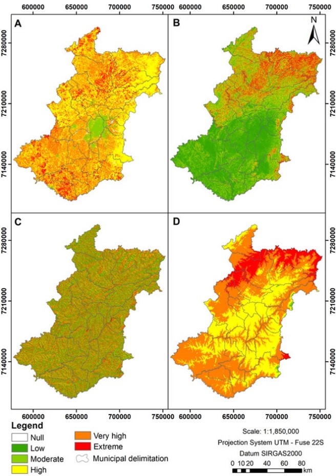
Forest fires are becoming increasingly frequent throughout the globe, influencing socioeconomic and environmental aspects and endangering ecosystems and life. The forest fire risk zoning is an auxiliary tool for elaborating and implementing preventive policies. The present study aims to execute the forest fire risk zoning for the metropolitan region of Curitiba, Paraná, Brazil, testing its efficiency through the relationship with geolocated fires that occurred from 2011 to 2016. Thematic maps were made through information related to demographic density, road system, land use and cover, slope, orientation and altimetry of the terrain. The efficiency of the proposed zoning, 45.8% and 44.0% of the geolocated fires that occurred in the study area in the period 2011 to 2016 were present in areas considered with "very high" and "high" risk, respectively, demonstrating that the proposed zoning can be used to develop prevention policies for the metropolitan region of Curitiba.
Los incendios forestales son cada vez más frecuentes en todo el planeta, influyendo en aspectos socioeconómicos y ambientales, poniendo en peligro los ecosistemas y la vida. La zonificación de riesgo de incendios forestales es una herramienta auxiliar para la elaboración e implementación de políticas preventivas. El presente estudio tiene como objetivo ejecutar la zonificación de riesgo de incendios forestales para la región metropolitana de Curitiba, Paraná, Brasil, probando su eficiencia a través de la relación con incendios geolocalizados ocurridos en el período de 2011 a 2016. Se realizaron mapas temáticos a través de información relacionada con los factores demográficos. densidad, sistema vial, uso y cobertura del suelo, pendiente, orientación y altimetría del terreno. De la eficiencia de la zonificación propuesta, el 45,8% y el 44,0% de los incendios geolocalizados ocurridos en el área de estudio en el periodo 2011 al 2016 estuvieron presentes en áreas consideradas con riesgo "muy alto" y "alto", respectivamente, demostrando que la zonificación propuesta La zonificación se puede utilizar para desarrollar políticas de prevención para la región metropolitana de Curitiba.
Referencias
Ajin, R.S., Loghin, A.M., Jacob, M.K., Vinod, P.G., and Krishnamurthy, R.R., The risk assessment study of potential forest fire in Idukki Wildlife Sanctuary using RS and GIS techniques. International Journal of Advanced Earth Science and Engineering, [online]. 5(1), pp. 308-318, 2016. Available at: https://cloudjl.com/index.php/EarthScience/issue/view/47/39
Annual Mapping Project of Land Cover and Use in Brazil (MAPBIOMAS). Coleção 5.0 da Série Anual de Mapas de Cobertura e Uso de Solo do Brasil [Online]. 2020. [date of reference May 10th of 2020]. Available at: https://mapbiomas.org/
Alvares, C.A., Stape, J.L., Sentelhas, P.C., Gonçalves, J.L.M., and Spavorek, G., Köppen’s climate classification map for Brazil. Meteorologische Zeitschrift, 22(6), pp. 711-728, 2013. DOI: https://doi.org/10.1127/0941-2948/2013/0507 DOI: https://doi.org/10.1127/0941-2948/2013/0507
Batista A.C., Oliveira, D.S., e Soares, R.V., Zoneamento de risco de incêndios florestais para o estado do Paraná. Curitiba, Brasil, FUPEF, 2002, 86 P.
Bowman, D.M.J.S., Balch, J., Artaxo, P., Bond, W.J., Cochrane, M.A., D’Antonio, C.M., Defries, R., Johnston, F.H., Keeley, J.E., Krawchuk, M.A., Kull, C.A., Mack, M., Moritz, M.A., Pyne, S., Roos, C.I., Scott A.C., Sodhi N.S., and Swetnam T.W., The human dimension of fire regimes on Earth. Journal of Biogeography, 38(12), pp. 2223-2236, 2011. DOI: https://doi.org/10.1111/j.1365-2699.2011.02595.x DOI: https://doi.org/10.1111/j.1365-2699.2011.02595.x
Brazilian Institute of Geography and Statistics (IBGE). Censo 2010, [online]. 2010. [date of reference March 21st of 2020]. Available at: https://censo2010.ibge.gov.br/resultados.html
Department of Highways of Paraná. Malha rodoviária, 2020. [date of reference June 20th of 2020]. Available at: http://www.der.pr.gov.br/Pagina/Malha-Rodoviaria
Eugenio, F.C., Santos, A.R., Fiedler, N.C., Ribeiro, G.A., Silva, A.G., Santos, A.B., Paneto, G.G., and Schettino, V.R., Applying GIS to develop a model for forest fire risk: a case study in Espírito Santo, Brazil. Journal of Environmental Management, 173, pp. 65-71, 2016. DOI: https://doi.org/10.1016/j.jenvman.2016.02.021 DOI: https://doi.org/10.1016/j.jenvman.2016.02.021
Ferraz, S.F.B., e Vettorazzi, C.A., Mapeamento de risco de incêndios florestais por meio de sistema de informações geográficas (SIG). Scientia Forestalis, 26(53), pp. 39-48, 1998.
Ferreira, H.R., Análise das ocorrências de incêndios em vegetação na região metropolitana de Curitiba-PR, no período de 2011 a 2016. Dissertação MSc. Engenharia Florestal, Brasil, Universidade Federal do Paraná, Brazil, 2021, 137 P.
Ferreira, H.R., Batista, A.C., Tetto, A.F., Kovalsyki, B., e dos Santos, J.F.L., Incêndios em vegetação em conjunto com outros materiais combustíveis na interface urbano-rural de Curitiba-PR. BIOFIX Scientific Journal, 5(1), pp. 108-113, 2020. DOI: https://doi.org/10.5380/biofix.v5i1.67832 DOI: https://doi.org/10.5380/biofix.v5i1.67832
Ho, T.L., Batista, A.C., and Tetto, A.F. Forest fire risk forecast for the state of Santa Catarina due to climate changes. Floresta, 47(4), pp. 427-436, 2017. DOI: https://doi.org/10.5380/rf.v47i4.50877 DOI: https://doi.org/10.5380/rf.v47i4.50877
Institute of Land, Cartography and Geography of Paraná. Relatório de cálculo de área dos municípios do estado do Paraná - ano 2019, [online]. 2019. [date of reference June 10th of 2020]. Available at: http://www.itcg.pr.gov.br/arquivos/File/Dados_2019/RELATORIO_DE_CALCULO_DE_AREA_DOS_MUNICIPIOS_DO_PARANA2019.pdf
Koproski, L.P., Ferreira, M.P., Goldammer, J.G., e Batista, A.C., Modelo de zoneamento de risco de incêndios para unidades de conservação brasileiras: o caso do Parque Estadual do Cerrado (PR). Floresta, 41(3), pp. 551-562, 2011. DOI: https://doi.org/10.5380/rf.v41i3.24049 DOI: https://doi.org/10.5380/rf.v41i3.24049
Kovalsyki, B., Batista, A.C., Tetto, A.F., Sousa, N.J., Carmo, M.R.B., and Soares, R.V., Forest fire risk zoning for the Vila Velha State Park and its surroundings (Ponta Grossa, Paraná). Floresta, 50(4), pp. 1818-1826, 2020. DOI: https://doi.org/10.5380/rf.v50i4.65974 DOI: https://doi.org/10.5380/rf.v50i4.65974
Lourenço, L., Fernandes, S., Bento-Gonçalves, A., Castro, A., Nunes, A., e Vieira, A., Causas de incêndios florestais em Portugal continental. Análise estatística da investigação efetuada no último quindénio (1996 a 2010). Cadernos de Geografia, 30/31, pp. 61-80, 2012. DOI: https://doi.org/10.14195/0871-1623_31_7 DOI: https://doi.org/10.14195/0871-1623_31_7
Maack, R., Geografia física do Estado do Paraná. Ponta Grossa, Brasil, UEPG, 2012, 526 P.
Mota, P.H.S., Rocha, S.J.S.S., Castro, N.L.M., Marcatti, G.E., França, L,C,J., Schettini, B.L.S., Villanova, P,H., Santos, H,T., and Santos, A,R., Forest fire hazard zoning in Mato Grosso State, Brazil. Land Use Policy, 88, art. 104206, 2019. DOI: https://doi.org/10.1016/j.landusepol.2019.104206 DOI: https://doi.org/10.1016/j.landusepol.2019.104206
Oliveira, D.S., Zoneamento de risco de incêndios em povoamentos florestais no norte de Santa Catarina. Dissertação Tesis MSc. em Ciências Florestais, Universidade Federal do Paraná, Brasil, 2002, 124 P.
Ribeiro, L., Koproski, L.P., Stolle, L., Lingnau, C., Soares, R.V., e Batista, A.C., Zoneamento de risco de incêndios florestais para a fazenda experimental do Canguiri, Pinhais (PR). Floresta, 38(3), pp. 561-572, 2008. DOI: https://doi.org/10.5380/rf.v38i3.12430 DOI: https://doi.org/10.5380/rf.v38i3.12430
Sá, A., Nero, M., Tavares-Júnior, J., Candeias, A., e Nobrega, R., Comparação e validação da modelagem espacial de riscos de incendios considerando diferentes métodos de predição. Bulletin of Geodetic Sciences, 23(4), pp. 556-577, 2017. DOI: https://doi.org/10.1590/s1982-21702017000400037 DOI: https://doi.org/10.1590/s1982-21702017000400037
Salas, J., and Chuvieco, E., Geographic information systems for wildland fire risk mapping. Wildfire, 3(2), pp. 7-13, 1994.
Setzer, A.W., Sismanoglu, R.A., e Santos, J.G.M., Método do cálculo do risco de fogo do Programa do Instituto Nacional de Pesquisas Espaciais (INPE) - Versão 11, [online]. 2019. [date of reference May 18th of 2024]. Available at: http://mtc-m21c.sid.inpe.br/col/sid.inpe.br/mtc-m21c/2019/11.21.11.03/doc/publicacao.pdf
Soares, R.V., Batista, A.C., e Tetto, A.F., Incêndios florestais: controle, efeitos e uso do fogo. Curitiba, Brasil, 2017, 255 P.
Tetto, A.F., Batista, A.C., Soares, R.V. Zoneamento de risco de incêndios florestais para a Floresta Nacional de Irati, estado do Paraná, Brasil. Scientia Forestalis, 40(94), pp. 259-265, 2012.
Yathish, H., Athira, K.V., Preethi, K., Pruthviraj, U., and Shetty, A., A Comparative analysis of forest fire risk zone mapping methods with expert knowledge. Journal of the Indian Society Remote Sensing, 47(12), pp. 2047-2060, 2019. DOI: https://doi.org/10.1007/s12524-019-01047-w DOI: https://doi.org/10.1007/s12524-019-01047-w
Cómo citar
IEEE
ACM
ACS
APA
ABNT
Chicago
Harvard
MLA
Turabian
Vancouver
Descargar cita
Licencia
Derechos de autor 2024 DYNA

Esta obra está bajo una licencia internacional Creative Commons Atribución-NoComercial-SinDerivadas 4.0.
El autor o autores de un artículo aceptado para publicación en cualquiera de las revistas editadas por la facultad de Minas cederán la totalidad de los derechos patrimoniales a la Universidad Nacional de Colombia de manera gratuita, dentro de los cuáles se incluyen: el derecho a editar, publicar, reproducir y distribuir tanto en medios impresos como digitales, además de incluir en artículo en índices internacionales y/o bases de datos, de igual manera, se faculta a la editorial para utilizar las imágenes, tablas y/o cualquier material gráfico presentado en el artículo para el diseño de carátulas o posters de la misma revista.


